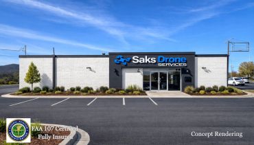
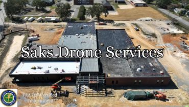
Commercial Aerial Photography for Remote Property Owners & Managers Anniston, Alabama

Commercial Aerial Photography for Remote Property Owners & Managers Anniston, Alabama

Remote Property Owners & Managers
We provide reliable, consistent aerial and ground photography for:
What We Deliver
Why Remote Clients Use Saks Drone Services
Why Ongoing Aerial Documentation Matters
For remote property owners and managers, regular aerial and ground photography provides a reliable record of roof, parking lot, and site conditions over time. It supports tenant turnover documentation, pre‑loss condition records, insurance claims, and regulatory or lender compliance—all with evidence‑quality imagery that stays consistent across visits. You can track conditions, manage tenants, and maintain compliance without being on‑site.
“All imagery is captured for long‑term record‑keeping, reporting, and compliance—not for real‑estate marketing.”

FAA Part 107 compliant, insured commercial drone operator providing remote property visibility, aerial documentation, and visual records for property owners and managers.

Out-of-state investors, REITs, and property managers rely on accurate, up-to-date visuals to protect their commercial property assets.
From roof conditions and parking lot striping to façade updates and site improvements, our high-resolution imagery delivers clear, objective insight into your investment, helping you verify work quality, track progress, and maintain accountability. See your property clearly. Manage confidently—no matter where you are.

Ground level oblique photo of a medical clinic

Aerial drone perspective of a shopping plaza

Non-invasive aerial and ground photography for property documentation and visual updates.

Aerial perspective before updates

Aerial perspective after updates

Commercial Visual Documentation

Exterior structure and site photography
Parking areas, access points, signage, and improvements
Consistent angles for repeat documentation

High-resolution drone imagery
FAA-authorized flights when required
Site overviews, roof visibility, surrounding context

Parking Lot Before Renovation

Parking Lot After Renovation

Parking Lot After Renovation

Parking Lot Renovation Details

Parking Lot Renovation Details

Parking Lot Renovation Details

Compliance-Driven Operations
FAA Part 107 certified operator
Fully licensed and insured
Experience and Reliability
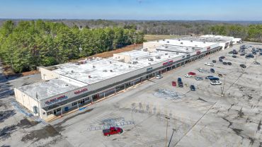
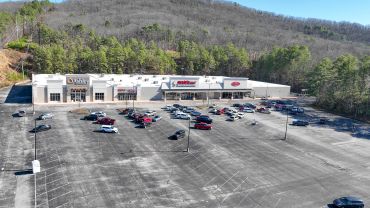
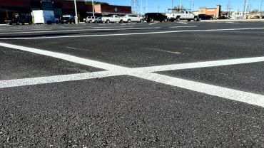
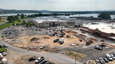
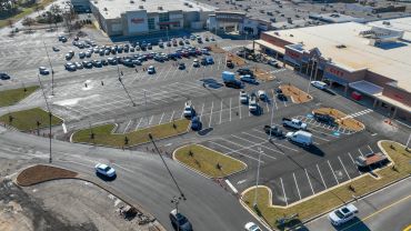
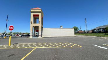
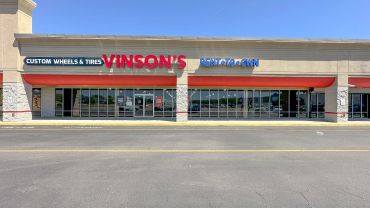
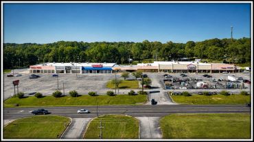
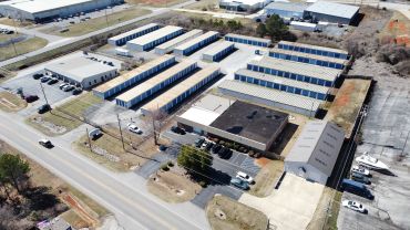
Saks Drone Services has provided ongoing aerial and ground photography services for commercial property firms, including long-term contracts with out-of-state organizations. Our clients rely on us for consistent delivery, clear communication, and dependable scheduling.
Saks Drone Services provides professional aerial photography documentation services intended to support property observation, asset monitoring, and general documentation needs. All imagery is captured and delivered for informational purposes only and does not constitute legal, engineering, insurance, appraisal, or forensic analysis.
Saks Drone Services does not guarantee legal admissibility, regulatory compliance, or evidentiary acceptance of any imagery in judicial or administrative proceedings. Clients are responsible for determining the suitability of delivered materials for their specific legal, insurance, or compliance requirements. Original files are retained and handled according to standard professional practices but are not represented as certified evidence.
Please leave a voice message or drop us an email @ SaksDroneServices@yahoo.com
Mon | 09:00 am – 05:00 pm | |
Tue | 09:00 am – 05:00 pm | |
Wed | 09:00 am – 05:00 pm | |
Thu | 12:00 pm – 05:00 pm | |
Fri | 12:00 pm – 05:00 pm | |
Sat | Closed | |
Sun | Closed |
We use cookies to analyze website traffic and optimize your website experience. By accepting our use of cookies, your data will be aggregated with all other user data.